The Ebstorf Map
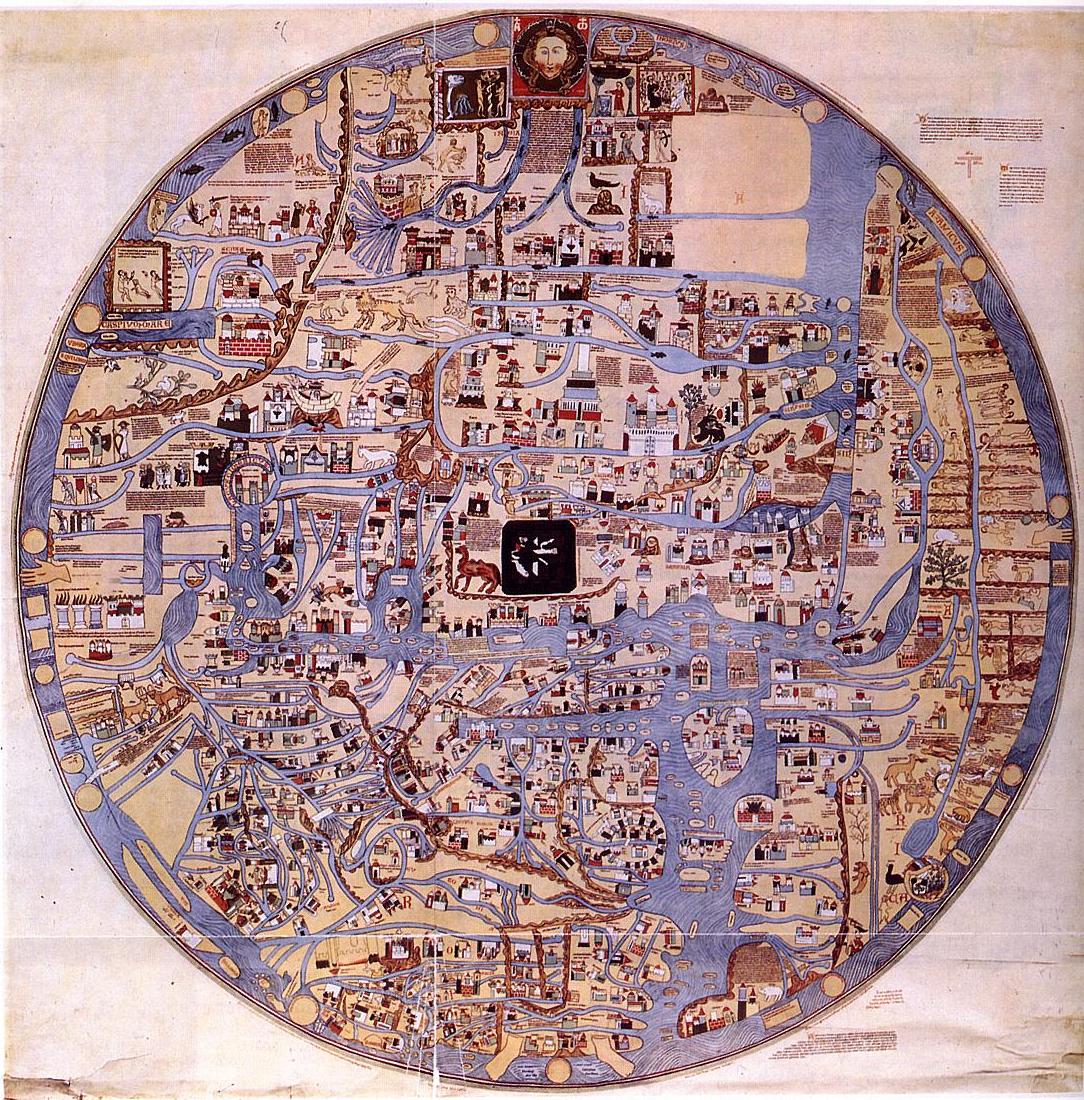
The Ebstorf Map is one of the finest examples of a mappa mundi from the High Middle Ages. It was produced probably in Germany in the early thirteenth century. Its creator may possibly be the writer and courtier Gervase of Tilbury, an Englishman working in the court of the German Emperor whose book Otia Imperialia engages in geographical survey and is particularly interested in monsters and marvels.
The map was enormous, about twelve feet by twelve feet. It perhaps was produced at the Benedictine monastery at Ebstorf, Germany (not far from Hanover). It exists today only in facsimile: the original was destroyed in the Allied bombing of that area in World War Two. It may have had close artistic connections with the Hereford Mappa Mundi, which still survives. (Click here for an interactive exploration of the Hereford Mappa Mundi.)
Reminder: as is typical in medieval maps, east is on the top, west on the bottom (a 90° rotation from our modern cartographical norm).
The map was enormous, about twelve feet by twelve feet. It perhaps was produced at the Benedictine monastery at Ebstorf, Germany (not far from Hanover). It exists today only in facsimile: the original was destroyed in the Allied bombing of that area in World War Two. It may have had close artistic connections with the Hereford Mappa Mundi, which still survives. (Click here for an interactive exploration of the Hereford Mappa Mundi.)
Reminder: as is typical in medieval maps, east is on the top, west on the bottom (a 90° rotation from our modern cartographical norm).
Gallery of Details
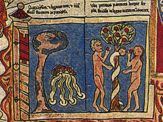
The Garden of Eden, located at the topmost (easternmost) part of the map, just to the left of Christ's head. Its placement and its depiction of the long-past moment of the Fall encourages the viewer to read the map chronologically, from top to bottom.
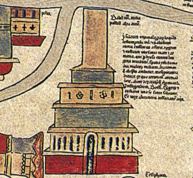
The Tower of Babel. Though no longer standing, its depiction on the Ebstorf Mappa Mundi again emphasizes the "historical" nature of the cartographic layout.
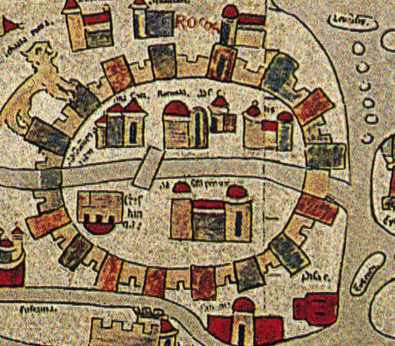
The Ebstorf Map construes Rome mainly as a conglomeration of churches within city walls.
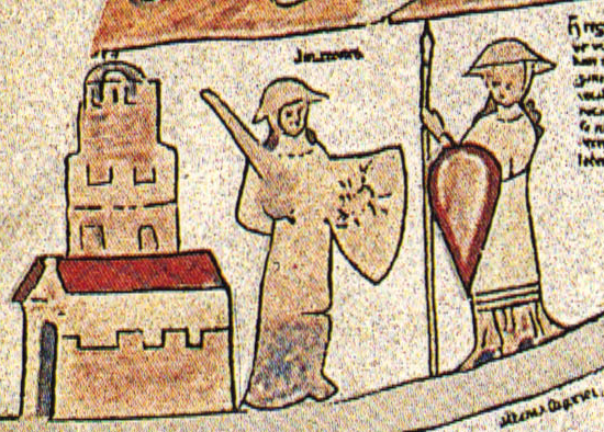
Amazons, located on the Ebstorf Map in north-central Asia. The traditions about the Amazons are filtered through late classical and early medieval sources (Orosius, Martianus Capella, Isidore of Seville) and derive ultimately from Herodotus.
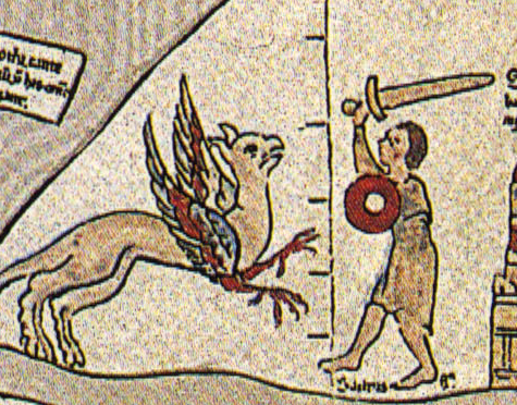
A man fights a griffin, found on the Ebstorf map in north Asia.
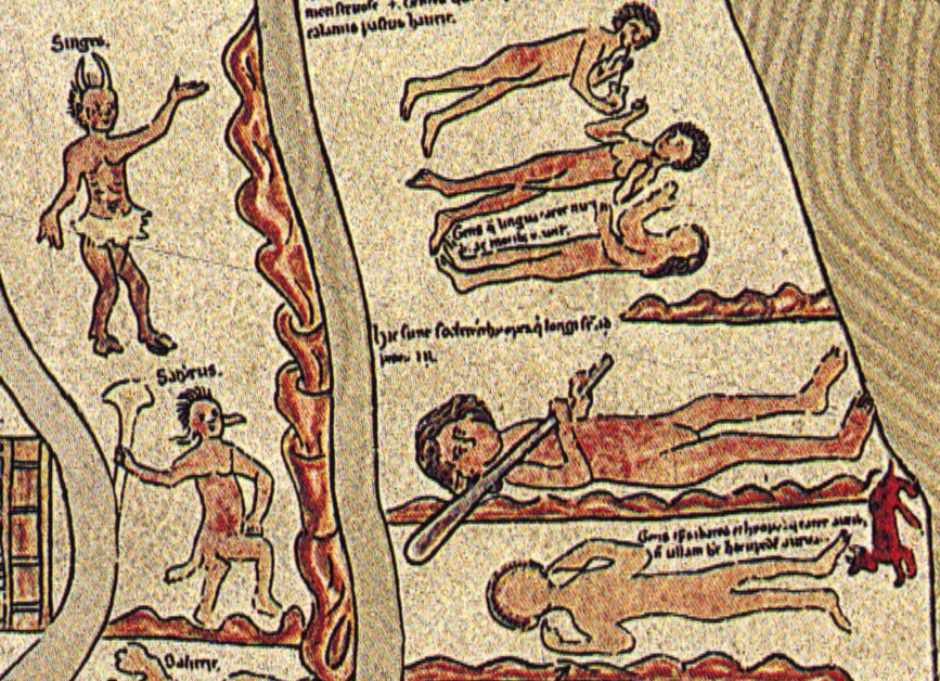
Many other "monstrous races" (giants, satyrs, horned men, etc.) appear on the southern side of the Ebstorf Map.
|
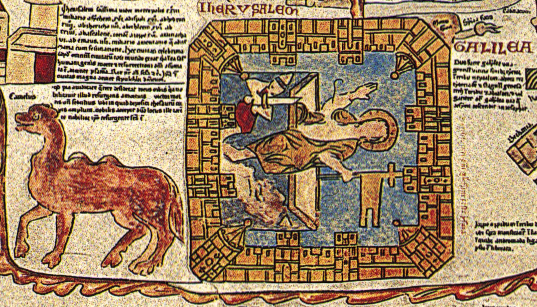
The Ebstorf Map's depiction of Jerusalem, here a walled city, focuses on the Resurrection of Christ. As it sits at the center of the map, it thus also suggests that the Resurrection is the central moment in history. The map also evinces European awareness that the biosphere of the Holy Land was somewhat different from Europe — note the camel!
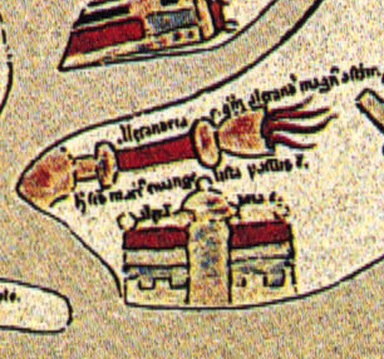
Ebstorf's detailing of Alexandria (then still one of the largest cities of the world) focuses on the famed Lighthouse.
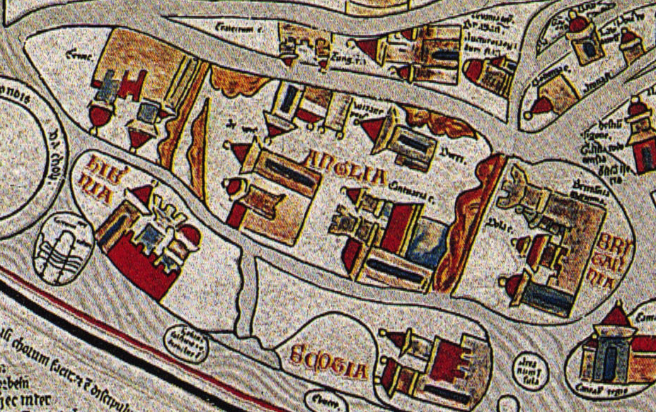
The British Isles, here pictured, are squashed at the bottom of the map. They appear slightly smaller than Sicily. The Ebstorf Map also imagines Scotland and Ireland as separate islands to the west of England/Britain.
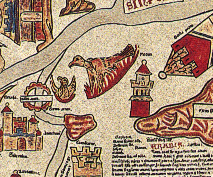
The Phoenix, which the Ebstorf Map, following long traditions, places in Arabia, rises from its self-immolation. The Red Sea protrudes on the right.
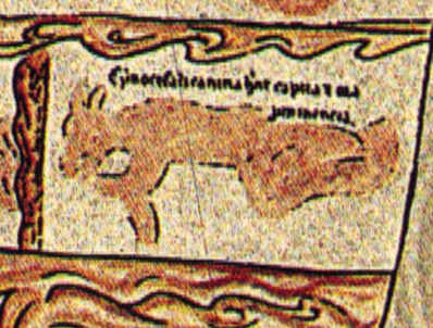
The Ebstorf Mappa Mundi places the various "monstrous races" at the edges of the map. The cynocephali (dog-headed people) appear on the right side of the map, somewhere in Africa.
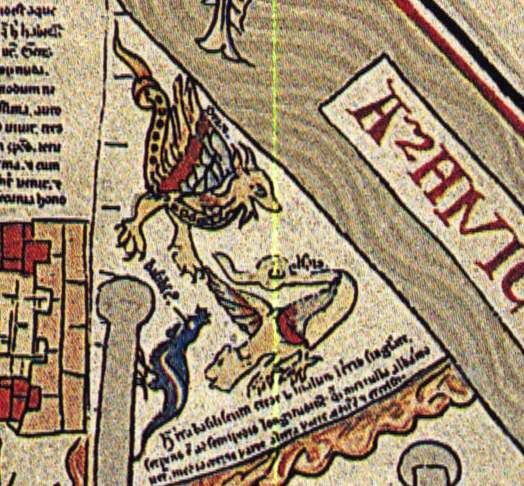
The African continent on the Ebstorf Map is also the site of a variety of marvelous beasts -- here a dragon, a basilisk, and a wyvern.
|
